By Tom Simon
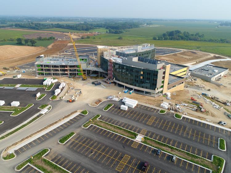
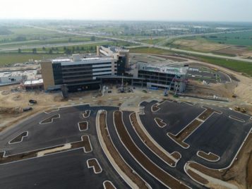
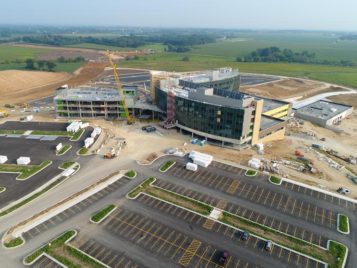
If you want to see how the $505-million Mercyhealth Hospital and Trauma Center-Riverside in Rockford, Illinois is being built, just look to the sky. In a first for Mortenson, the builder is using drones to map, plan and manage complex site utilization faster and better than traditional methods make possible.
Unlike the unmanned aerial vehicles used to produce those entertaining novice videos on YouTube, these drones are delivering precision video and images with dimensional data of the 65-acre construction site in near real time. The builder integrates the drone-captured data and images with the project’s BIM and other software tools to enhance decision-making.
Not long ago, only the builder’s technology specialists, called integrated construction coordinators, could easily access and manipulate data and images like those generated by drones. With advances in the technology tools and devices and how the ICCs create programs, it’s so simple and fast that important project information is just a few clicks or taps away for superintendents, project engineers and subcontractors and their crews.
Site logistics
Mortenson has relied on the drone images and information to inform how it controls earth moving, site grading and stockpiling of clay fill and topsoil. The drone captures the topography to aid in cost estimating. And the builder reviews the visuals to verify and show compliance with the storm water pollution plan (an Illinois Environmental Protection Agency requirement).
In a 30-minute flight with a predetermined path and height, a drone can do the work of two people surveying and gathering data onsite for two full days and producing a report a week later. The drone images and data are also more accurate.
The perspectives offered by the drone also influence how the builder approaches site accessibility. In the past, Mortenson would use aerial photography superimposed on the BIM or walk the site. Drones, in contrast, provide video, are less laborious and more real time.
The drones have helped with making decisions about siting temporary entrances, exits and parking, as well as track the progress on installation of permanent roads, parking lots and underground utilities.
Schedule management
The general superintendent applies the drone data and images to help determine the best ways to stockpile, stage and monitor materials, as well as manage the placement and movement of equipment and plan and coordinate crews and their work. The use goes far beyond coordination of MEP installations to comparing actual work and site conditions to the planned and future scopes in the 3-D models.
Because of the ambitious schedule for this project, the builder has had three crews working simultaneously to install HVAC, fire and other systems. At its peak, there were 600 craftworkers onsite daily, with 3,000 who have worked on the project so far.
Given the complexity and sheer numbers of people involved, it’s the main tool the general superintendent uses during the plan-of-the-day meetings, which are attended by all onsite foremen and other project members. When the builder merges the drone-generated images with other data, the result is a Google Earth-like image that can be pulled up on a big-screen TV in the construction site trailer.
Quality control
In the field, all subcontractors are required to have iPads for accessing the cloud-based BIM360 Glue program, which facilitates 3-D coordination, and which they can consult for the most up-to-date version of the project plans to manage their work, resolve conflicts and avoid rework. The program also links to Procore, which serves as a repository for all project information. Craftworkers, in particular, have found that having onsite access to the model, images and data, combined with the required use of the Trimble tool for laying out placement of hangers, braces and other system supports, makes work go more smoothly.
Drones meticulously capture as-built work, from site utilities to in-progress steel and concrete. Measurements can be made within one inch to confirm everything, from placement of light poles and the helipad layout, to the grading for parking lots, matches the plans. Drone data also can give visual confirmation that work is being done properly, especially for areas not easily accessible after the fact, including for waterproofing, roofing systems and curtainwall systems.
Safety
The drone images and video give a full 360 degree view of the site, helping everyone understand where different crews are setting up and moving to. The superintendent uses the visuals to point to work locations for the day and notify the team of site changes or ongoing work to be aware of, such as the digging of underground utilities or crane use. The superintendent also uses the images to spot any possible issues, such as workers getting too close to the wetlands.
In addition, the drones can reduce or eliminate the need for someone to visually inspect hard-to-reach or potentially dangerous locations, including confined space installations, structural steel and safety rails and systems.
How it works
Mortenson works with Uplift Data Partners to determine the flight path every two weeks, and then Uplift flies the drones and provides the data, video and analysis. The builder arranges for the flights to occur in late afternoon or evening, depending on available daylight, when fewer workers are onsite. Uplift places the data and video from each flight into a shared folder, from which the builder downloads the information for various uses, including integrating into the BIM and creating visuals for easy access.
The drones have proven incredibly versatile and useful at the Mercyhealth project, helping the team stay safe and on schedule and supporting quality efforts. The information, video and images the drones provide have made it easier to communicate, coordinate and successfully run such a complex site.
Photos courtesy of Uplift Data Partners.
Tom Simon is a general superintendent at Mortenson Construction.


 Join our thriving community of 70,000+ superintendents and trade professionals on LinkedIn!
 Search our job board for your next opportunity, or post an opening within your company.
 Subscribe to our monthly
Construction Superintendent eNewsletter and stay current.