
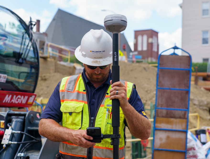
“Trust but verify” is a useful way to think about how a general contractor works with the subcontractors laying out their work. Dellbrook, a New England construction management firm, relies on this workflow. The company does not do self-perform; everything is subcontracted out and then quality checked by an internal team. The company works in academic, multifamily residential, healthcare and commercial markets.
For years, that verification was limited to whatever the field superintendent could do with a tape, a building corner, a control point or a wheel measure. Most of the time, the subcontractors were right, but “most of the time” leaves space for the times a point has moved. That’s where centimeter-level RTK GNSS changes the equation for teams like Dellbrook. Instead of guessing or relying on manual measurements, every point could be verified with precision.
This is the story of how the company empowered its team to improve quality checks — and how the rollout grew job by job.
Jay Miller, Dellbrook’s construction technology specialist bridges superintendents, project management and IT. He sought out to equip field teams with RTK GNSS for accurate daily checks, speeding up workflows and reducing rework. Because the solution had to work across multiple crews, the Dellbrook RTK rollout was driven by what would actually hold up on a jobsite, not by a top-down standard.
The challenge: Running quality checks and verifying subcontractors’ work
On most Dellbrook jobs, layout points come from one of two places: the site surveyor on a scheduled visit or a subcontractor setting out their own work. Surveyors usually get it right, but the risk sits in the middle ground between those periodic surveys — where a point can move, or a site contractor doesn’t lay things out properly and the field superintendent doesn’t have a clean way to confirm it.
Not every superintendent has a surveying background. Without surveying RTK gear, verification options are limited: a tape, a building corner, a control point or a wheel measure. “When you’re out on the site … you’re looking at an open area. There’s often no nearby, reliable point of measure,” Miller says.
The cost of the gap is uneven. Most days it’s nothing. Other days, it’s a slab penetration that ends up off enough to need rework, which gets expensive fast.
Calling a surveyor back to verify wasn’t always practical either. “Whether it’s a week for them to come out, a couple of days, a lot of time, that’s too much time. We move fast,” Miller says. “Secondly, there’s a cost. Between cost and the timing, that’s where we would get that gap Emlid fills.”
The opportunity: GNSS as a practical, accessible tool
Miller was looking for GNSS equipment the field team could actually use — not leave in a truck.
He’d seen what didn’t work; a superintendent at a previous company had invested in a $10,000 RTK kit with an attached Windows tablet. They brought it to the site once, used it and never touched it again. The interface was legacy. It would have required two days of training to use properly. That stuck with Miller.
When he started exploring solutions, he kept one principle in mind: He would be rolling out and training the equipment. It had to work without asking field staff to learn new systems or manage separate hardware.
That’s when he heard about Emlid GNSS receivers used as a base station for drone mapping. Initially, it came up through DroneDeploy — which Dellbrook already uses for drone mapping on some jobs — but when Miller looked deeper, he saw other capabilities of Emlid’s stack. Emlid’s approach is simple: a receiver pairs with Emlid Flow, an app that runs on phones the field team already carries. No Windows tablets. No proprietary training. The CAD files are uploaded from the office in the cloud-based Emlid Flow 360 platform and are immediately available in the Emlid Flow field app. Once the receiver is on site, it’s up and running, ready for the job.
For corrections, most of Dellbrook’s jobs use the free Massachusetts RTK network, so no separate base station to manage. The complexity just wasn’t there. For Miller, that practical simplicity was the difference between adoption and a device sitting in a truck.
 How the rollout actually went
There was no formal rollout. Miller brought it up in project managers and superintendent meetings, and the program grew from there. A couple of times, Miller flagged a job himself where he thought RTK would help; most of the time, the team came to him.
Miller won’t order a unit unless there’s a job in hand and the PM has signed off on the cost. That kept the rollout disciplined: no shelf inventory, no idle units.The fleet is currently eight Emlid Reach receivers — the RS3 and RS4 models.
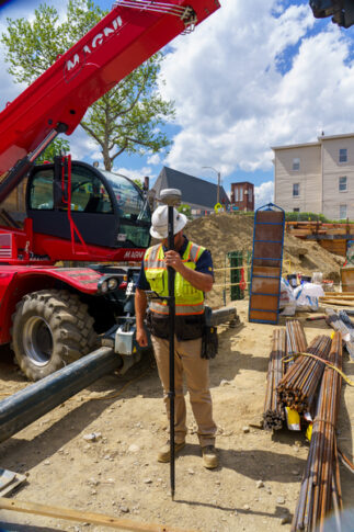
Training stays light and Miller handles it himself: getting the rover on the Massachusetts NTRIP network from the office, then heading on-site to walk the team through stakeout, the control localization workflow and the basics of capturing points. Sometimes one session is enough; on others, he’s had to go out and train a couple of times.
The receivers with IMU tilt compensation let the team skip leveling the rod for every point — what Miller calls “bubbling.”
“That was a big selling point,” he says. “Just stick the thing in the ground and look at the phone.”
The workflow: Keeping office and field in sync
The handoff is consistent across jobs. When a superintendent signals they want to use the kit — usually around the time the trailer goes out to the site — Miller orders the unit and requests the latest CAD files plus a clear note on what the team actually needs to see.
CAD files usually contain foundations, undergrounds, site structures like stormwater and the architectural overlaid on the civil, so the team can plan penetrations. “I like how toggling layers is intuitive, allowing the field to easily toggle only what they need to see on that walk,” Miller says.
Dellbrook MEP coordination and the BIM department now handles file preparations and uploads directly into Emlid Flow 360. The BIM director finds the job, uploads the cleaned-up DXF and visually checks that it lands in the right spot on the map.
When Miller heads to the site for the training session, that file is already waiting in the Emlid Flow mobile app on the field team’s phones.
But the workflow doesn’t stop there. As the team collects points in the field, the data syncs back in real time. Miller or the BIM director can log in from the office, watch points coming in when captured and flag issues before the work moves forward. No end-of-day reports and no email chains with yesterday’s data.
The outcome: Trust grows as verification is part of the routine
Most of the use is verification — about 75% of the time, after work is installed. A superintendent or field engineer walks the site with the rover and the phone, checking penetrations against the slab plan, locations against the civil drawing and grades against control. Centimeter accuracy is enough; Dellbrook isn’t doing control, just checking.
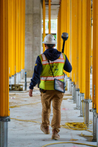
The most concrete win came about a week into the rollout, on the first job to actively use the kit. The site had an existing power line and pole the team couldn’t easily translate from the plans to how close it actually sat to the work.
Standing at the planned building corner with the rover, the field team realized the pole was close enough that an excavator or a lift wasn’t going to physically fit when it came time to build. Without RTK, this problem would have caused a substantial schedule delay. With RTK, the field team caught it on an early site walk.
Slab penetrations are another use the team is starting to bring the kit into. A field engineer with a rover and Emlid Flow can walk the slab, zoom in on the plan and visually confirm each penetration against the design.
There’s also a softer effect that’s harder to measure: checking changes how subcontractors work. “Once you check them once, they’re going to spend a lot more time making sure everything’s correct,” Miller says. He hasn’t tracked it formally yet, but it’s the kind of behavior change expected once subcontractors know someone’s looking.
Lessons for other superintendents
Three things made the rollout work at Dellbrook. The first is the framing. The verification gap isn’t about subcontractors doing bad work or surveyors being unreliable. It’s structural, built into the time between a layout point getting set and the next person checking it. Naming it that way is what made RTK an obvious tool. Nobody had to be wrong for the kit to be right.
The second is the fit. Miller had seen an RTK setup fail at a past project because it was complicated to operate, and it ran on a Windows tablet, which added a point of maintenance and failure. He picked Emlid because it’s ready to use, and the workflow ran on the phone that the field already carried. The lesson travels: the best field-tech is usually the one who doesn’t add a device.
The third is the rollout. Miller never mandated RTK on a job. He surfaced it in project managers and superintendent meetings, made every unit job-costed and let demand pull. The receivers that ended up in trailers were the ones that supers and PMs actively wanted there — a stronger filter than central procurement.
Dellbrook can still trust the process. Now they can verify it, too, with a clear framing, a kit that fits the day and a rollout the field bought into one job at a time.
Photos courtesy of Dellbrook
 Join our thriving community of 70,000+ superintendents and trade professionals on LinkedIn!
 Search our job board for your next opportunity, or post an opening within your company.
 Subscribe to our monthly
Construction Superintendent eNewsletter and stay current.
Subscribe to our monthly
Construction Superintendent eNewsletter and stay current.