


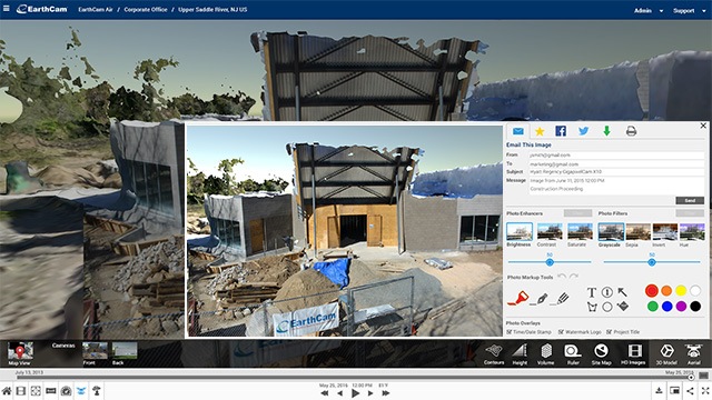
EarthCam Air combines EarthCam’s webcam technology with Unmanned Aerial Vehicle services, cloud-based storage solutions and distribution tools for sharing unique content. EarthCam has discovered that when UAVs are combined with webcams, a powerful geospatial model emerges. Throughout the life of the project, teams can attach webcam images, geo-tagged photographs and video analytics to the point cloud derived from drone flight data. The data-driven imagery provides valuable insight for construction management and a critical tool to support potential claims and disputes.
 Join our thriving community of 70,000+ superintendents and trade professionals on LinkedIn!
 Search our job board for your next opportunity, or post an opening within your company.
 Subscribe to our monthly
Construction Superintendent eNewsletter and stay current.
Subscribe to our monthly
Construction Superintendent eNewsletter and stay current.